Mumbai Metro map of the published network: view all lines, open a coloured line map for stop-by-stop stations, and download a PNG for offline use.
Data checked: 28 Oct 2026 · Confirm on official metro site before travel Mumbai Metro official site
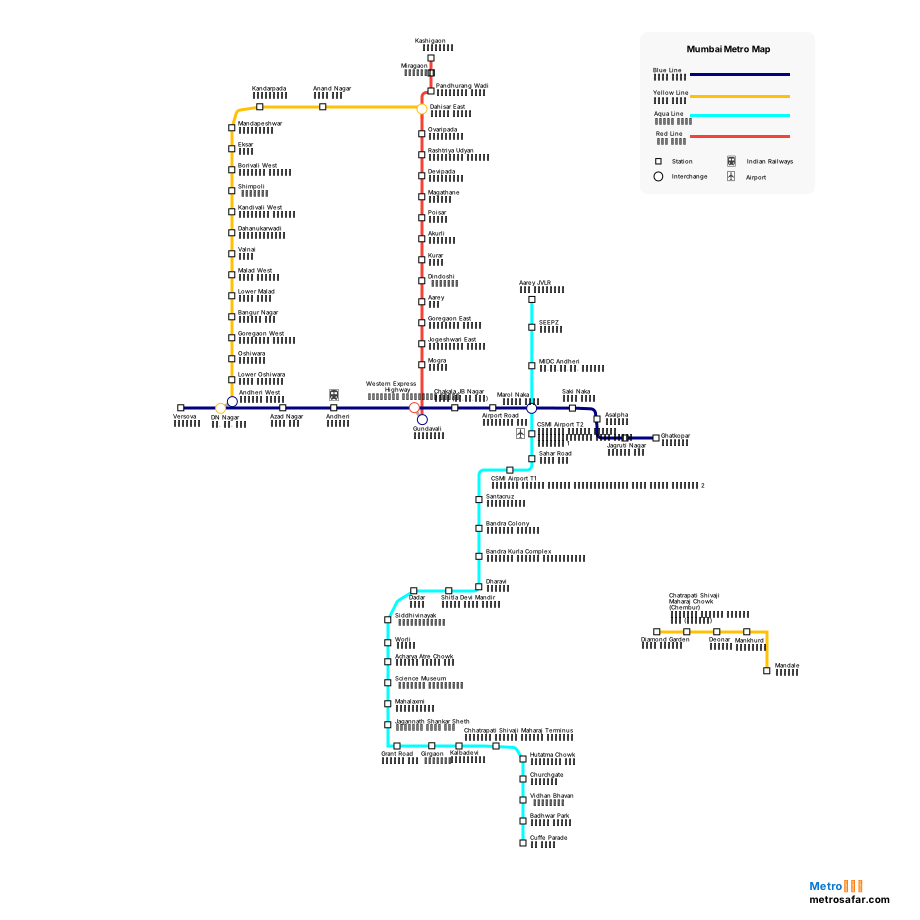
Mumbai Metro map of the published network: view all lines, open a coloured line map for stop-by-stop stations, and download a PNG for offline use.
Use Download map on this page to save a PNG of the Mumbai Metro network map for offline viewing. Line pages also offer a download for that corridor.
Scroll to Metro Line Map and open any coloured line (for example Red Line). Each line page shows an interactive route map, terminals, interchanges, and the full station sequence.
This page is the Mumbai Metro route map. Use the interactive network view, then open Blue Line, Aqua Line, Yellow Line, or another published corridor for the station sequence.